Open fields is probably the last thing you would expect to find in central London today. An area as developed as Seven Dials, just north of Covent Garden, is as typical as anywhere in the West End with upmarket boutiques and fine dining fighting to make use of every possible scrap of land. Landlords know that the more businesses they can squeeze in, the more rent they get to collect.
But turn back the clock 350 years ago and, as Hollar’s Great Map of 1658 shows, open space is what a visitor to this now vibrant part of corner of the capital would have found. That changed in the 1690s however when politician Thomas Neale – a highly influential figure in late Stuart England – started to lay out Seven Dials, a development with seven (it was originally planned to be six) streets converging on a circular central area with an iconic monument.

Seven Dials
Neale hoped to cash in on the popularity of nearby fashionable Covent Garden piazza – which was popular with well heeled residents – and the layout was designed to pack in as many properties as possible. Although Seven Dials never did attract the volume of middle class patrons that was originally intended and different standards of houses (some subdivided) catered for people on a range of income levels. And at one stage each of the street corners facing the central column boasted a pub (only one, the Crown, now remains – the other corner units are occupied by the likes of Cafe Nero, a clothing shop and a Radisson hotel which is housed in a former homeless hostel).
Today, some regard Seven Dials as merely an extension of the high end shopping area of Covent Garden. Despite attempts to keep the focus on independent businesses, international brands that can’t get a spot around the old market piazza are increasingly opting to open up here and are bringing the crowds of wealthy shoppers with them. Quite what long-term residents must think about the changing character of this area is a different matter. It’s now a place where you don’t need to go far to buy a pair of designer shoes, but won’t find anywhere selling a pint of milk on your doorstep.
Traces of the past
To really get under the skin of Seven Dials you need to adopt a slower pace – and explore with a guide who can pick out traces from the past. I therefore joined another of Ken Titmuss’s (aka the Old Map Man) tours. As I described in a blog about Bermondsey’s leather-making industry, these are unique in London as they make use of maps to help uncover forgotten areas of the capital.
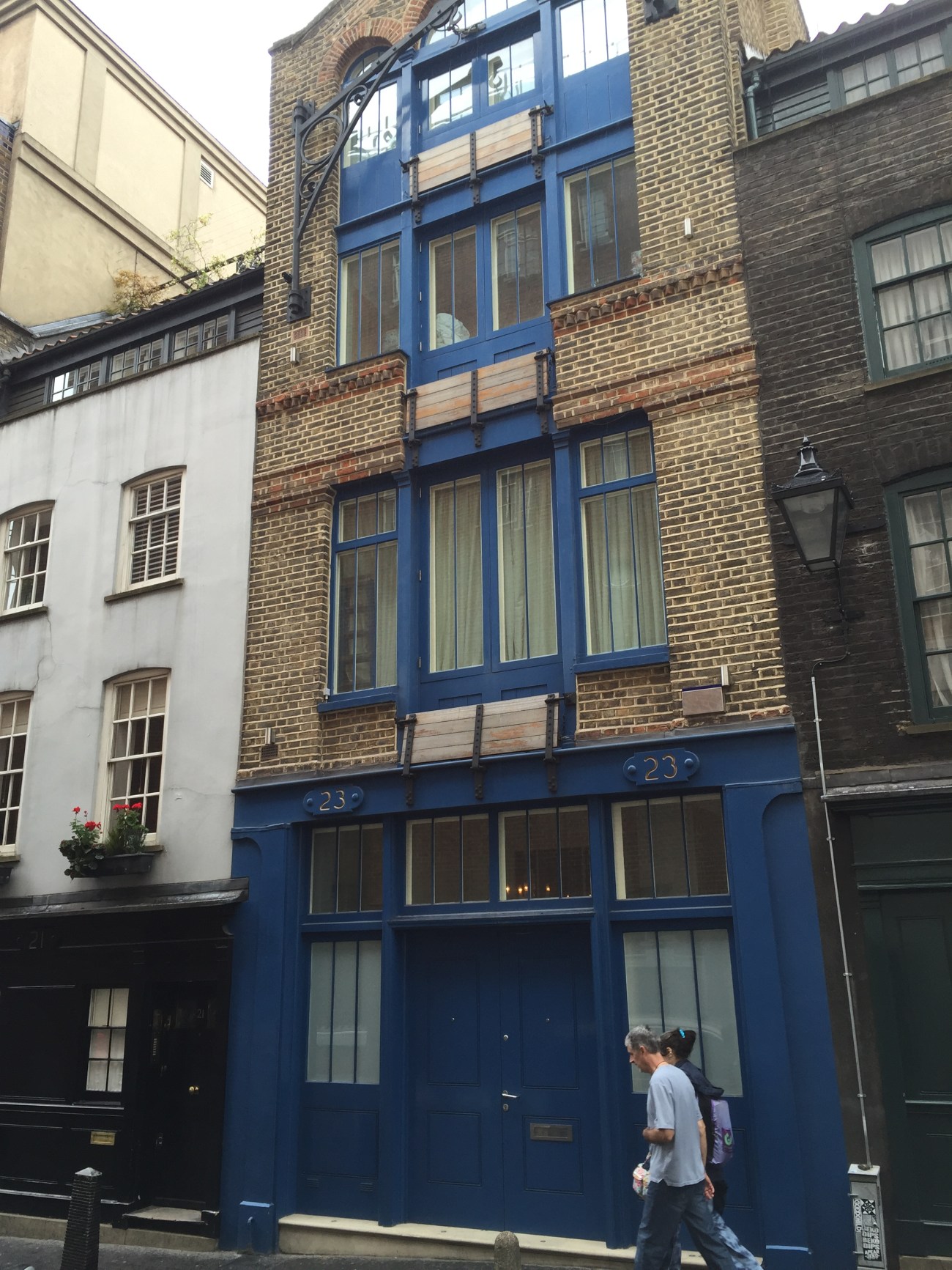
We walked a number of the seven streets that Neale designed and stopped to look at what would have been some of the earliest terraced houses to be built in the new development. Some had clearly been modified (with hoists and trap doors) over the years so that they could be used as warehouses. As the fruit and vegetable market took over Covent Garden – and well-to-date residents moved out – Seven Dials adapted as well.
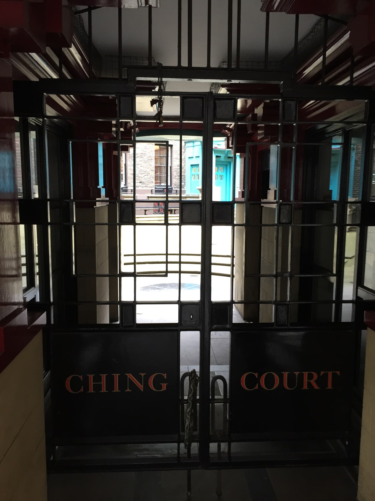
This became the centre of London’s metal making industry, with builders coming from far and wide to pick up everything from door handles to coat hooks. For instance, the premises of Comyn Ching, the ironmongers, are remembered in Shelton Street in a housing development called Ching Court which has one a string of awards (a resident returning home seemed quite surprised when told about the site’s history by Ken).
Elsewhere in the area there were woodcarvers, hat manufacturers, booksellers, wigmakers and breweries (the Woodyard Brewery was founded in 1740 and, as is apparent on old maps, expanded considerably over the next century and produced 500,000 barrels a year at peak, before vacating its buildings in 1905). While old brick-built warehouses can still be seen on a number of the streets in and around Seven Dials, it is particularly rewarding to enter Neal’s Yard. If you look beyond the various shops selling alternative forms of medicine, health food cafes and the like, it’s very clear that these are old workshop buildings housing wheelwrights and other trades.
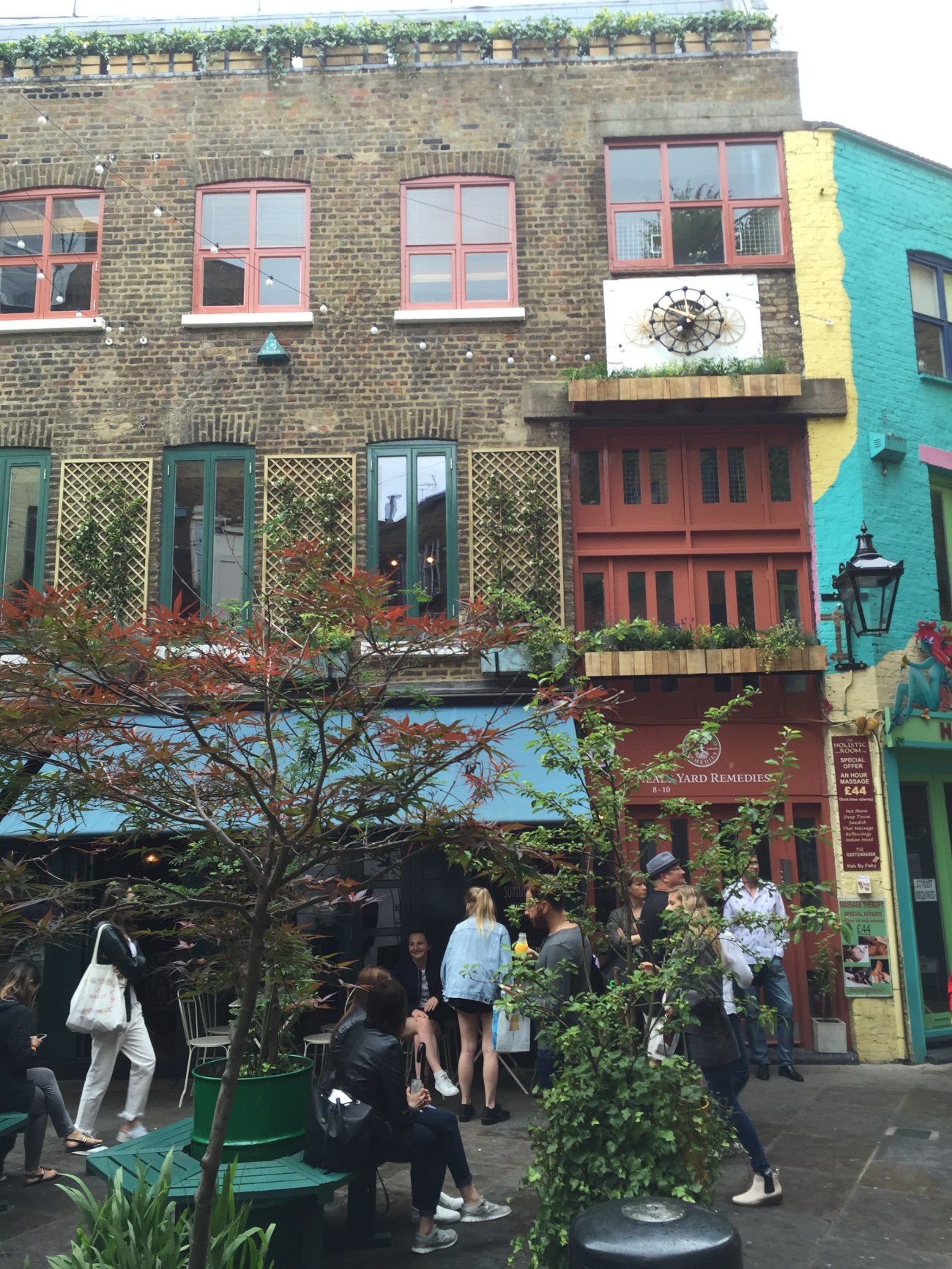
Neal’s Yard
But time the area gradually deteriorated and by the 19th century bordered the rookery of St Giles, which was regarded one of London’s worst slums. Charles Dickens described it in Sketches by Boz: “The stranger who finds himself in the Dials for the first time…at the entrance of Seven obscure passages, uncertain which to take, will see enough round him to keep his curiosity awake for no inconsiderable time…” Although Ken’s walk also included this part of St Giles (along with many other interesting streets and hidden buildings), I’ve written an entire blog about this based on the account of Thomas Beames so won’t repeat myself.
But development in these parts goes back much further than that started by Thomas Neale in the 1690s. Land on which the new streets of Seven Dials were built originally belonged to a leper hospital. The Hospital of St Giles was founded by Queen Matilda, wife of Henry II, in the 12th century. As I noted in my earlier St Giles blog, the marshes and open fields in which it was built provided a physical barrier separating it from London.
Like others in the area, St Giles which was taken over by Henry VIII in the 16th century. The Crown subsequently let the hospital land on a series of leases. Neale purchased the remainder of a lease (which expired in 1731) for what became Seven Dials, for some £4000, and subsequently paid ground rents of £800 per annum for buildings on the land. It never made him the riches he hoped it would and he died insolvent in 1699, leaving others to continue with the development.
Very early on Neale commissioned renowned carver Edward Pierce to design a Sundial Pillar to form the centre-piece of the circus where the seven streets converge. It was topped by six sundial faces representing each of the original planned six streets (it was designed before it was decided that a seventh should be added). The original column was removed in 1773 (contrary to what some books say, it was actually knocked down in an attempt to stop a dangerous mob from gathering there) and the replacement seen today was installed in 1989 thanks to what is today the Seven Dials Trust.
Given the crowds that now descend on Seven Dials – which was declared a Conservation Area in 1974 – it is a shame that the streets in this area have not been pedestrianised. So many want people to sit in front of the column and enjoy eating lunch bought from one of the nearby food stalls. Yet sadly, often you need to battle through busy traffic to get through to the central island. Banning cars and other vehicles would allow visitors to appreciate further the wonderful, albeit changed, district that Neale so wonderfully envisaged.
Historic housing on Mercer Street
Categories: Changing London, Housing, Westminster
